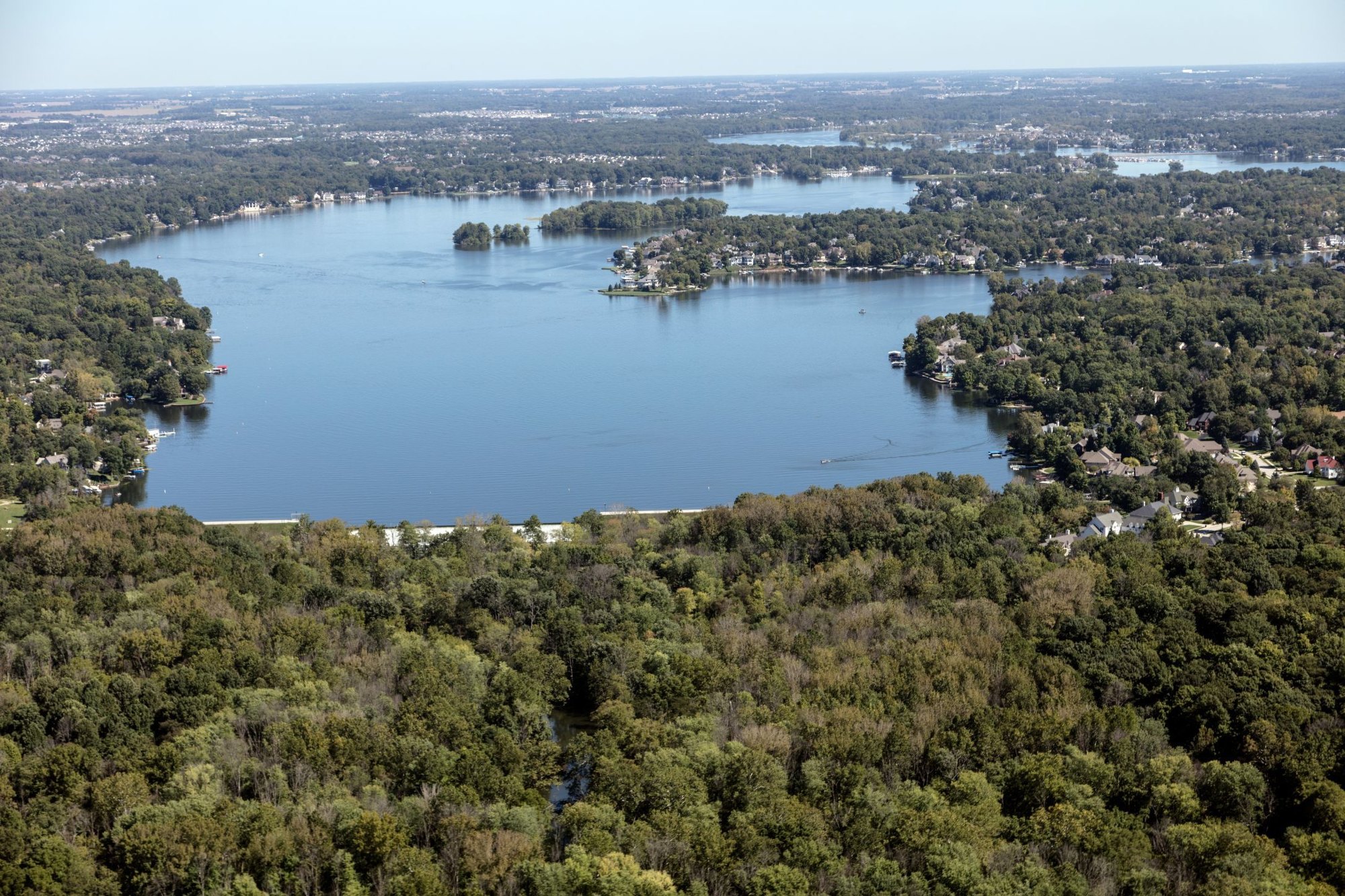
Geist Reservoir area aerial by Carol M. Highsmith, September 19, 2016

Outdoors

Picnic spots near Fishers

Day-use and picnic areas near Fishers on public land, from quick drives to full-day outings.

Good to know: Group picnic sites can often be reserved; fire rules change with the season, so check before bringing a grill.

30 to 75 miles (9)

52 mi north · US Army Corps of Engineers

Mississinewa Lake

Mississinewa Lake: the name Mississinewa was derived from the Miami Indian word "Mis-chis-in-wah," which means water on a slope. The area is rich in Indian history.

  • Biking
  • Boating
  • Camping
  • Fishing
  • Hiking
  • History
  • Hotel/Lodge/Resort Privately Owned
  • Nature education

60 mi southwest · US Army Corps of Engineers

Cagles Mill Lake

Cagles Mill Lake: The control tower is round and the outlet works conduit was mined through solid rock. Cataract Falls, with upper and lower falls, is the largest waterfall (by volume) in Indiana.

  • Boating
  • Fishing
  • Hiking
  • Nature education
  • Picnicking
  • Water sports
  • Wildlife viewing

60 mi north · US Army Corps of Engineers

Salamonie Lake

Salamonie Lake: was derived from the Indian word "O-sah-mo-nee" which means "yellow paint." The Indians made yellow dye and paint from the bloodroot that grew abundantly along the banks of the stream.

  • Biking
  • Boating
  • Camping
  • Fishing
  • Hiking
  • Horseback riding
  • Nature education
  • Picnicking

61 mi west · US Army Corps of Engineers

Cecil M. Harden Lake

The fall forest colors are vivid in October when Parke County holds its nine-day Covered Bridge Festival. Cecil M.

  • Boating
  • Camping
  • Fishing
  • Hiking
  • Nature education
  • Picnicking
  • Water sports
  • Wildlife viewing

63 mi southeast · US Army Corps of Engineers

Brookville Lake

Brookville Lake, IN lies in the heart of the Whitewater River Valley. This area has long been acknowledged as one of the most picturesque and historically significant in the State of Indiana.

  • Boating
  • Camping
  • Fishing
  • Hiking
  • Horseback riding
  • Hotel/Lodge/Resort Privately Owned
  • Nature education
  • Picnicking

63 mi southeast · US Army Corps of Engineers · Campground

Quakertown Campground

This recreation area is part of Brookville Lake

  • Camping
  • Picnicking

63 mi southeast · US Army Corps of Engineers · Campground

Tailwater Shelter 2 (Brookville Lake)

The Tailwater #2 Shelter is located at the base of Brookville Lake Dam. 9136 SR101 Brookville, Indiana 47012 Visitors enjoy the accessibility to cold water trout fishing in the tailwater and the river access offered by this site.

  • Camping
  • Fishing
  • Picnicking

67 mi northeast · US Army Corps of Engineers

J. Edward Roush Lake

J. Edward Roush Lake (formerly Huntington): of the 20 lakes in the Louisville District, J.

  • Boating
  • Camping
  • Fishing
  • Nature education
  • Picnicking
  • Water sports
  • Wildlife viewing

70 mi south · Fish and Wildlife Service

Muscatatuck National Wildlife Refuge

Muscatatuck National Wildlife Refuge was established in 1966 as a refuge to provide feeding and resting areas for migratory birds.

  • Archery
  • Biking
  • Birding
  • Boating
  • Educational Programs
  • Fishing
  • Hiking
  • Hunting

75 miles and farther (16)

92 mi southeast · US Army Corps of Engineers

West Fork of Mill Creek Lake

West Fork Lake, OH is leased to the Hamilton County Park District and is part of the 2,630-acre Winton Woods Park. The park includes two State Dedicated Nature Preserves including Spring Beauty Dell and the Greenbelt Area.

  • Boating
  • Camping
  • Fishing
  • Hiking
  • Horseback riding
  • Hotel/Lodge/Resort Privately Owned
  • Picnicking
  • Water sports

98 mi southeast · US Army Corps of Engineers

Ohio River - Markland Pool

An important navigation feature in the Ohio River System. Sightseers may watch the navigation locking process. This area is along the Lewis and Clark route.

  • Boating
  • Fishing
  • Picnicking
  • Water sports
  • Wildlife viewing

104 mi south · USDA Forest Service · Campground

Youngs Creek Campground

A primitive campground with vault toilets, hitching racks, and a picnic shelter is available. Around 12 and half miles of trails are available for hiking, mountain biking and horse riding.

  • Backpacking
  • Camping
  • Hiking
  • Horse Camping
  • Horseback riding
  • Mountain Biking
  • Picnicking

106 mi south · USDA Forest Service

Hoosier National Forest

Hoosier National Forest, in the hills of south central Indiana, provides a wide mix of opportunities and resources for people to enjoy.

  • Biking
  • Boating
  • Camping
  • Fire Lookouts/Cabins Overnight
  • Fishing
  • Hiking
  • Horse Camping
  • Horseback riding

107 mi east · US Army Corps of Engineers

Caesar Creek Lake

Caesar Creek Lake, OH sits astride the crest of the Cincinnati Arch, a nationally recognized resource that is visited by fossil collectors from all over the world.

  • Biking
  • Boating
  • Camping
  • Fishing
  • Hiking
  • History
  • Horseback riding
  • Hotel/Lodge/Resort Privately Owned

113 mi south · US Army Corps of Engineers

Patoka Lake

Patoka Lake: two pairs of bald eagles established nests during the spring of 1992 through 1997.

  • Biking
  • Boating
  • Camping
  • Fishing
  • Hiking
  • Nature education
  • Picnicking
  • Water sports

117 mi south · US Army Corps of Engineers

Ohio River - McAlpine Pool

Provides a navigational channel between Louisville and Cincinnati that is an integral part of Ohio River navigation.

  • Hiking
  • Picnicking

118 mi east · US Army Corps of Engineers · Campground

Cj Brown Dam And Reservoir - Dam Site (Oh)

C.J. Brown Reservoir is located in west-central Ohio, two miles northeast of Springfield; thirty-five miles northeast of Dayton, and forty-five miles west of Columbus.

  • Biking
  • Camping
  • Fishing
  • Hiking
  • Picnicking
  • Ranger programs
  • Wildlife viewing

118 mi east · US Army Corps of Engineers

Clarence J. Brown Dam and Reservoir

C.J. Brown Dam & Reservoir, OH is located on the northeast corner of Springfield on the Buck Creek, 7 miles above its confluence with Mad River. The project is home to two rare fen communities.

  • Boating
  • Camping
  • Fishing
  • Hiking
  • History
  • Hotel/Lodge/Resort Privately Owned
  • Nature education
  • Picnicking

122 mi southwest · National Park Service

George Rogers Clark National Historical Park

The British flag would not be raised above Fort Sackville Feb. 25, 1779. At 10 A.M., the garrison surrendered to American Colonel George Rogers Clark.

  • History
  • Picnicking

122 mi southeast · US Army Corps of Engineers

William H. Harsha Lake

William H. Harsha Lake, OH is located on the East Fork of the Little Miami River in Clermont County. In 1869 there were two active gold mines on the project.

  • Biking
  • Boating
  • Camping
  • Fishing
  • Hiking
  • History
  • Horseback riding
  • Picnicking

126 mi southeast · US Army Corps of Engineers

Ohio River - Meldahl Pool

Captain Anthony Meldahl Locks & Dam is located at mile marker 436 on the Ohio River. It creates a 95 mile navigational pool between Meldahl Locks & Dam and Greenup Locks & Dam.

  • Boating
  • Camping
  • Picnicking
  • Water sports
  • Wildlife viewing

130 mi northwest · National Park Service · Campground

Dunewood Campground

Indiana Dunes National Park hugs 15 miles (24 km) of the southern shore of Lake Michigan and has much to offer.

  • Amphitheater
  • Backpacking
  • Beach
  • Biking
  • Birding
  • Boating
  • Camping
  • Canoeing

130 mi northwest · National Park Service

Indiana Dunes National Park

Lake Michigan's might has influenced Indiana Dunes for millennia. Wind and waves have shaped the land, leaving a rich mosaic of habitats along these 15 miles of Indiana coast.

  • Biking
  • Boating
  • Camping
  • Fishing
  • Hiking
  • History
  • Paddling
  • Picnicking

131 mi northwest · National Park Service · Campground

Dunbar Group Site

Indiana Dunes National Park hugs 15 miles (24 km) of the southern shore of Lake Michigan and has much to offer.

  • Beach
  • Biking
  • Birding
  • Boating
  • Camping
  • Canoeing
  • Cross Country Skiing
  • Cultural Activities

135 mi southwest · Fish and Wildlife Service

Patoka River National Wildlife Refuge and Management Area

The Patoka River in Southwest Indiana had long been recognized for its wetland and wildlife values on a local, statewide and regional basis.

  • Birding
  • Boating
  • Educational Programs
  • Fishing
  • Hiking
  • Hunting
  • Motor Boat
  • Non-Motorized Boating

Distances are straight-line miles from downtown Fishers. Listings come from Recreation.gov’s federal recreation database; check each official page for hours, fees, fire restrictions and closures before you go.

More outdoors near Fishers

Questions

Where is the closest place for picnic spots near Fishers?

Mississinewa Lake (US Army Corps of Engineers), about 52 miles north of Fishers as the crow flies. Next are Cagles Mill Lake (60 mi) and Salamonie Lake (60 mi).

When is the best time for picnic spots near Fishers?

Based on Fishers’s average highs, April–October. Conditions at higher elevations can be much cooler.

Who manages these places?

Federal agencies including US Army Corps of Engineers, National Park Service, Fish and Wildlife Service. Each listing links to its official page for hours, fees, closures and current conditions.

Fishers AI

Your Fishers local guide
Hey there!

I'm Fishers AI. Ask about neighborhood food, independent shops, local history or planning a visit.

AI recommendations may be inaccurate. Verify hours and prices. Questions are processed by Cloudflare. Privacy